Normal view

There are new articles available, click to refresh the page.
Before yesterdayMain stream

NASA Flights Study Cosmic Ray Effects for Air, Future Space Travelers

25 September 2025 at 17:34

4 min read

Preparations for Next Moonwalk Simulations Underway (and Underwater)

Recent airborne science flights to Greenland are improving NASA’s understanding of space weather by measuring radiation exposure to air travelers and validating global radiation maps used in flight path planning. This unique data also has value beyond the Earth as a celestial roadmap for using the same instrumentation to monitor radiation levels for travelers entering Mars’ atmosphere and for upcoming lunar exploration.

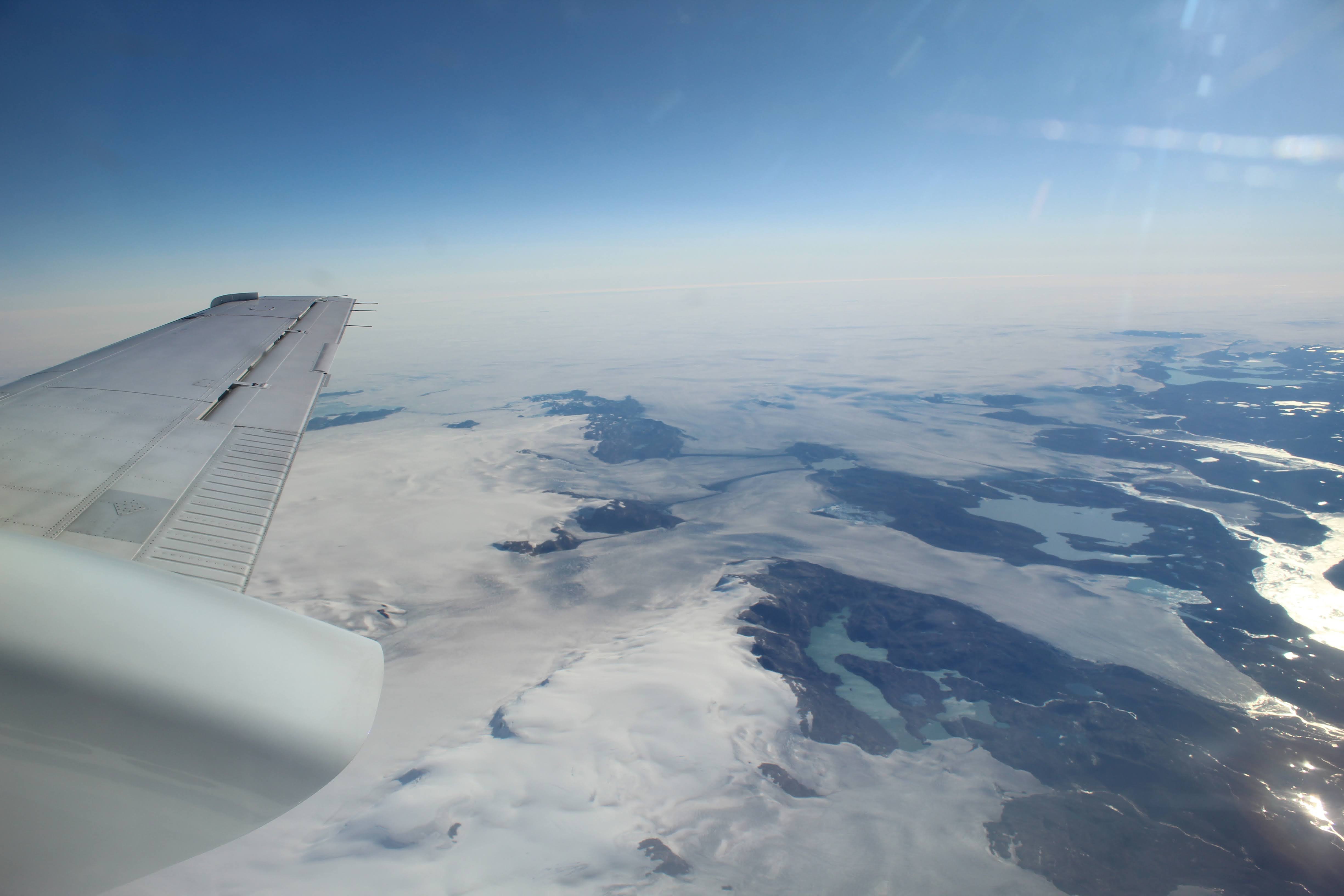
NASA’s Space Weather Aviation Radiation (SWXRAD) aircraft flight campaign took place August 25-28 and conducted two five-hour flights in Nuuk, Greenland. Based out of NASA’s Langley Research Center in Hampton, Virginia, the mission gathered dosimetry measurements, or the radiation dose level, to air travelers from cosmic radiation. Cosmic radiation is caused by high-energy particles from outer space that originate from our Sun during eruptive events like solar flares and from events farther away, like supernovae in our Milky Way galaxy and beyond.

Photo shows two researchers sitting in the back of an aircraft working on laptops and reviewing incoming data. The image composition shows the round cabin shape and rows of round windows on either side of the aircraft with light coming in during a flight.
Science team partners from Honeywell reviewing dosimeter data on board NASA’s B200 King Air during a flight over Nuuk, Greenland.
NASA/Guillaume Gronoff

“With NASA spacecraft and astronauts exploring the Moon, Mars, and beyond, we support critical research to understand – and ultimately predict – the impacts of space weather across the solar system,” said Jamie Favors, director of NASA’s Space Weather Program at NASA Headquarters in Washington. “Though this project is focused on aviation applications on Earth, NAIRAS could be part of the next generation of tools supporting Artemis missions to the Moon and eventually human missions to Mars.”

Two heliophysics researchers are seen in the doorway of NASA's B200 King Air aircraft holding and discussing a dol
Jamie Favors, NASA Space Weather Program director, and Chris Mertens, SWXRAD principal investigator, discussing a dosimeter at NASA’s Langley Research Center as specialized instruments are integrated onto NASA’s B200 King Air aircraft before deploying to Greenland.
NASA/Mark Knopp

NASA’s Nowcast of Aerospace Ionizing Radiation System, or NAIRAS, is the modeling system being enhanced by the SWXRAD airborne science flights. The model features real-time global maps of the hazardous radiation in the atmosphere and creates exposure predictions for aircraft and spacecraft.

NASA’s B200 King Air on the runway in Goose Bay, Canada, a stop during the flight to Nuuk, Greenland.
NASA/Guillaume Gronoff

“The radiation exposure is maximum at the poles and minimum at the equator because of the effect of Earth’s magnetic field. In the polar regions, the magnetic field lines are directed into or out of the Earth, so there’s no deflection or shielding by the fields of the radiation environment that you see everywhere else.” explained Chris Mertens, principal investigator of SWXRAD at NASA Langley. “Greenland is a region where the shielding of cosmic radiation by Earth’s magnetic field is zero.”

That means flight crews and travelers on polar flights from the U.S. to Asia or from the U.S. to Europe are exposed to higher levels of radiation.

Frozen and rocky terrain in the Polar region observed from above Nuuk, Greenland during NASA’s SWXRAD science flights.
NASA/Guillaume Gronoff

The data gathered in Greenland will be compared to the NAIRAS modeling, which bases its computation on sources around the globe that include neutron monitors and instruments that measure solar wind parameters and the magnetic field along with spaceborne data from instruments like the NOAA GOES series of satellites.

“If the new data doesn’t agree, we have to go back and look at why that is,” said Mertens. “In the radiation environment, one of the biggest uncertainties is the effect of Earth’s magnetic field. So, this mission eliminates that variable in the model and enables us to concentrate on other areas, like characterizing the particles that are coming in from space into the atmosphere, and then the transport and interactions with the atmosphere.”

An aerial view of Nuuk, Greenland. Blue skies with white clouds are in the top of the frame. Mountains and villages and buildings are in the center with dark blue water seen at the bottom portion of the image.
An aerial view of Nuuk, Greenland.
NASA/Guillaume Gronoff

The SWXRAD science team flew aboard NASA’s B200 King Air with five researchers and crew members. In the coming months, the team will focus on measurement data quality checks, quantitative modeling comparisons, and a validation study between current NAIRAS data and the new aircraft dosimeter measurements.

All of this information is endeavoring to protect pilots and passengers on Earth from the health risks associated with radiation exposure while using NASA’s existing science capabilities to safely bring astronauts to the Moon and Mars.

Northern Lights, or auroras, seen over the city of Nuuk, Greenland. Auroras are considered space weather and are easily visible effects of activity from the Sun interacting with the magnetosphere and Earth’s atmosphere.
NASA/Guillaume Gronoff

“Once you get to Mars and even the transit out to Mars, there would be times where we don’t have any data sets to really understand what the environment is out there,” said Favors. “So we’re starting to think about not only how do we get ready for those humans on Mars, but also what data do we need to bring with them? So we’re feeding this data into models exactly like NAIRAS. This model is thinking about Mars in the same way it’s thinking about Earth.”

The SWXRAD flight mission is funded through NASA’s Science Mission Directorate Heliophysics Division. NASA’s Space Weather Program Office is hosted at NASA Langley and facilitates researchers in the creation of new tools to predict space weather and to understand space weather effects on Earth’s infrastructure, technology, and society.

For more information on NASA Heliophysics and NAIRAS modeling visit:

NASA Space Weather

NASA’s Nowcast of Aerospace Ionizing Radiation System

About the Author

Charles G. Hatfield

Charles G. Hatfield

Science Public Affairs Officer, NASA Langley Research Center

New NASA Mission to Reveal Earth’s Invisible ‘Halo’

18 September 2025 at 12:15

5 min read

New NASA Mission to Reveal Earth’s Invisible ‘Halo’

This story is also available in Spanish.

A new NASA mission will capture images of Earth’s invisible “halo,” the faint light given off by our planet’s outermost atmospheric layer, the exosphere, as it morphs and changes in response to the Sun. Understanding the physics of the exosphere is a key step toward forecasting dangerous conditions in near-Earth space, a requirement for protecting Artemis astronauts traveling through the region on the way to the Moon or on future trips to Mars. The Carruthers Geocorona Observatory will launch from NASA’s Kennedy Space Center in Florida no earlier than Tuesday, Sept. 23.

Revealing Earth’s invisible edge

In the early 1970s, scientists could only speculate about how far Earth’s atmosphere extended into space. The mystery was rooted in the exosphere, our atmosphere’s outermost layer, which begins some 300 miles up. Theorists conceived of it as a cloud of hydrogen atoms — the lightest element in existence — that had risen so high the atoms were actively escaping into space.

But the exosphere reveals itself only via a faint “halo” of ultraviolet light known as the geocorona. Pioneering scientist and engineer Dr. George Carruthers set himself the task of seeing it. After launching a few prototypes on test rockets, he developed an ultraviolet camera ready for a one-way trip to space.

An astronaut stands on the Moon near a lunar module and scientific equipment, with an American flag and lunar rover in the background. The lunar surface is covered in footprints and gray dust.
Apollo 16 astronaut John Young is pictured on the lunar surface with George Carruthers’ gold-plated Far Ultraviolet Camera/Spectrograph, the first Moon-based observatory. The Lunar Module “Orion” is on the right and the Lunar Roving Vehicle is parked in the background next to the American flag.
NASA

In April 1972, Apollo 16 astronauts placed Carruthers’ camera on the Moon’s Descartes Highlands, and humanity got its first glimpse of Earth’s geocorona. The images it produced were as stunning for what they captured as they were for what they didn’t.

“The camera wasn’t far enough away, being at the Moon, to get the entire field of view,” said Lara Waldrop, principal investigator for the Carruthers Geocorona Observatory. “And that was really shocking — that this light, fluffy cloud of hydrogen around the Earth could extend that far from the surface.” Waldrop leads the mission from the University of Illinois Urbana-Champaign, where George Carruthers was an alumnus.

A false-color, close-up image of Earth’s exosphere as captured by the Carruthers Geocorona Observatory against a dark blue background. The image shows a semicircle glowing yellow and outlined in red.
The first image of UV light from Earth’s outer atmosphere, the geocorona, taken from a telescope designed and built by George Carruthers. The telescope took the image while on the Moon during the Apollo 16 mission in 1972.
G. Carruthers (NRL) et al./Far UV Camera/NASA/Apollo 16

Our planet, in a new light

Today, the exosphere is thought to stretch at least halfway to the Moon. But the reasons for studying go beyond curiosity about its size.

As solar eruptions reach Earth, they hit the exosphere first, setting off a chain of reactions that sometimes culminate in dangerous space weather storms. Understanding the exosphere’s response is important to predicting and mitigating the effects of these storms. In addition, hydrogen — one of the atomic building blocks of water, or H2O — escapes through the exosphere. Mapping that escape process will shed light on why Earth retains water while other planets don’t, helping us find exoplanets, or planets outside our solar system, that might do the same.

NASA’s Carruthers Geocorona Observatory, named in honor of George Carruthers, is designed to capture the first continuous movies of Earth’s exosphere, revealing its full expanse and internal dynamics.

“We’ve never had a mission before that was dedicated to making exospheric observations,” said Alex Glocer, the Carruthers mission scientist at NASA’s Goddard Space Flight Center in Greenbelt, Maryland. “It’s really exciting that we’re going to get these measurements for the first time.”

Download this video from NASA’s Scientific Visualization Studio.

Journey to L1

At 531 pounds and roughly the size of a loveseat sofa, the Carruthers spacecraft will launch aboard a SpaceX Falcon 9 rocket along with NASA’s IMAP (Interstellar Mapping and Acceleration Probe) spacecraft and the National Oceanic and Atmospheric Administration’s SWFO-L1 (Space Weather Follow On – Lagrange 1) space weather satellite. After launch, all three missions will commence a four-month cruise phase to Lagrange point 1 (L1), a location approximately 1 million miles closer to the Sun than Earth is. After a one-month period for science checkouts, Carruthers’ two-year science phase will begin in March 2026.

An artist’s concept showing a diagram including the Sun, Earth, and five labeled points (L1–L5) representing the Sun-Earth Lagrange Points, where gravitational forces balance in the Sun-Earth system, against the backdrop of space. L1, where the Carruthers spacecraft will orbit, is labeled with brighter, bold text. Earth is labeled as well.
Artist’s concept of the five Sun-Earth Lagrange points in space. At Lagrange points, the gravitational pull of two large masses counteract, allowing spacecraft to reduce fuel consumption needed to remain in position. The L1 point of the Earth-Sun system affords an uninterrupted view of the Sun and will be home to three new heliophysics missions in 2025: NASA’s Interstellar Mapping and Acceleration Probe (IMAP), NASA’s Carruthers Geocorona Observatory, and NOAA’s Space Weather Follow-On – Lagrange 1 (SWFO – L1).
NASA’s Conceptual Image Lab/Krystofer Kim

From L1, roughly four times farther away than the Moon, Carruthers will capture a comprehensive view of the exosphere using two ultraviolet cameras, a near-field imager and a wide-field imager.

“The near-field imager lets you zoom up really close to see how the exosphere is varying close to the planet,” Glocer said. “The wide-field imager lets you see the full scope and expanse of the exosphere, and how it’s changing far away from the Earth’s surface.”

The two imagers will together map hydrogen atoms as they move through the exosphere and ultimately out to space. But what we learn about atmospheric escape on our home planet applies far beyond it.

“Understanding how that works at Earth will greatly inform our understanding of exoplanets and how quickly their atmospheres can escape,” Waldrop said.

By studying the physics of Earth, the one planet we know that supports life, the Carruthers Geocorona Observatory can help us know what to look for elsewhere in the universe.

The Carruthers Geocorona Observatory mission is led by Lara Waldrop from the University of Illinois Urbana-Champaign. The Space Sciences Laboratory at the University of California, Berkeley leads mission implementation, design and development of the payload in collaboration with Utah State University’s Space Dynamics Laboratory. The Carruthers spacecraft was designed and built by BAE Systems. NASA’s Explorers and Heliophysics Projects Division at the agency’s Goddard Space Flight Center in Greenbelt, Maryland, manages the mission for the agency’s Heliophysics Division at NASA Headquarters in Washington.

By Miles Hatfield
NASA’s Goddard Space Flight Center, Greenbelt, Md.

Keep Exploring

Discover More Topics From NASA

NASA’s IMAP Mission to Study Boundaries of Our Home in Space

17 September 2025 at 11:12

6 min read

NASA’s IMAP Mission to Study Boundaries of Our Home in Space

Summary

  • NASA’s new Interstellar Mapping and Acceleration Probe, or IMAP, will launch no earlier than Tuesday, Sept. 23 to study the heliosphere, a giant shield created by the Sun.
  • The mission will chart the heliosphere’s boundaries to help us better understand the protection it offers life on Earth and how it changes with the Sun’s activity.
  • The IMAP mission will also provide near real-time measurements of the solar wind, data that can be used to improve models predicting the impacts of space weather ranging from power-line disruptions to loss of satellites, to the health of voyaging astronauts.

Space is a dangerous place — one that NASA continues to explore for the benefit of all. It’s filled with radiation and high-energy particles that can damage DNA and circuit boards alike. Yet life endures in our solar system in part because of the heliosphere, a giant bubble created by the Sun that extends far beyond Neptune’s orbit.

With NASA’s new Interstellar Mapping and Acceleration Probe, or IMAP, launching no earlier than Tuesday, Sept. 23, humanity is set to get a better look at the heliosphere than ever before. The mission will chart the boundaries of the heliosphere to help us better understand the protection it offers and how it changes with the Sun’s activity. The IMAP mission will also provide near real-time measurements of space weather conditions essential for the Artemis campaign and deep space travel. 

“With IMAP, we’ll push forward the boundaries of knowledge and understanding of our place not only in the solar system, but our place in the galaxy as a whole,” said Patrick Koehn, IMAP program scientist at NASA Headquarters in Washington. “As humanity expands and explores beyond Earth, missions like IMAP will add new pieces of the space weather puzzle that fills the space between Parker Solar Probe at the Sun and the Voyagers beyond the heliopause.”

Download this video from NASA’s Scientific Visualization Studio.

Domain of Sun

The heliosphere is created by the constant outflow of material and magnetic fields from the Sun called the solar wind. As the solar system moves through the Milky Way, the solar wind’s interaction with interstellar material carves out the bubble of the heliosphere. Studying the heliosphere helps scientists understand our home in space and how it came to be habitable.

As a modern-day celestial cartographer, IMAP will map the boundary of our heliosphere and study how the heliosphere interacts with the local galactic neighborhood beyond. It will chart the vast range of particles, dust, ultraviolet light, and magnetic fields in interplanetary space, to investigate the energization of charged particles from the Sun and their interaction with interstellar space.

The IMAP mission builds on NASA’s Voyager and IBEX (Interstellar Boundary Explorer) missions. In 2012 and 2018, the twin Voyager spacecraft became the first human-made objects to cross the heliosphere’s boundary and send back measurements from interstellar space. It gave scientists a snapshot of what the boundary looked like and where it was in two specific locations. While IBEX has been mapping the heliosphere, it has left many questions unanswered. With 30 times higher resolution and faster imaging, IMAP will help fill in the unknowns about the heliosphere.

Energetic neutral atoms: atomic messengers from our heliosphere’s edge

Of IMAP’s 10 instruments, three will investigate the boundaries of the heliosphere by collecting energetic neutral atoms, or ENAs. Many ENAs originate as positively charged particles released by the Sun but after racing across the solar system, these particles run into particles in interstellar space. In this collision, some of those positively charged particles become neutral, and an energetic neutral atom is born. The interaction also redirects the new ENAs, and some ricochet back toward the Sun.

Charged particles are forced to follow magnetic field lines, but ENAs travel in a straight line, unaffected by the twists, turns, and turbulences in the magnetic fields that permeate space and shape the boundary of the heliosphere. This means scientists can track where these atomic messengers came from and study distant regions of space from afar. The IMAP mission will use the ENAs it collects near Earth to trace back their origins and construct maps of the boundaries of the heliosphere, which would otherwise be invisible from such a distance.

“With its comprehensive state-of-the-art suite of instruments, IMAP will advance our understanding of two fundamental questions of how particles are energized and transported throughout the heliosphere and how the heliosphere itself interacts with our galaxy,” said Shri Kanekal, IMAP mission scientist at NASA’s Goddard Space Flight Center in Greenbelt, Maryland.

A circular spacecraft floats in space with stars and dust visible in the background.
The IMAP mission will study the heliosphere, our home in space.
NASA/Princeton University/Patrick McPike

Space weather: monitoring solar wind

The IMAP mission will also support near real-time observations of the solar wind and energetic solar particles, which can produce hazardous conditions in the space environment near Earth. From its location at Lagrange Point 1, about 1 million miles from Earth toward the Sun, IMAP will provide around a half hour’s warning of dangerous particles headed toward our planet. The mission’s data will help with the development of models that can predict the impacts of space weather ranging from power-line disruptions to loss of satellites.

“The IMAP mission will provide very important information for deep space travel, where astronauts will be directly exposed to the dangers of the solar wind,” said David McComas, IMAP principal investigator at Princeton University.

Cosmic dust: hints of the galaxy beyond

In addition to measuring ENAs and solar wind particles, IMAP will also make direct measurements of interstellar dust — clumps of particles originating outside of the solar system that are smaller than a grain of sand. This space dust is largely composed of rocky or carbon-rich grains leftover from the aftermath of supernova explosions. 

The specific elemental composition of this space dust is a postmark for where it comes from in the galaxy. Studying cosmic dust can provide insight into the compositions of stars from far outside our solar system. It will also help scientists significantly advance what we know about these basic cosmic building materials and provide information on what the material between stars is made of.

David McComas leads the mission with an international team of 27 partner institutions. APL is managing the development phase and building the spacecraft, and it will operate the mission. IMAP is the fifth mission in NASA’s Solar Terrestrial Probes Program portfolio. The Explorers and Heliophysics Projects Division at NASA Goddard manages the STP Program for the agency’s Heliophysics Division of NASA’s Science Mission Directorate. NASA’s Launch Services Program, based at NASA’s Kennedy Space Center in Florida, manages the launch service for the mission.

By Mara Johnson-Groh
NASA’s Goddard Space Flight Center, Greenbelt, Md.

Keep Exploring

Discover More Topics From NASA

❌
❌